Energy Data Solutions
Menu

PhD Research

Synergy of Ground and Satellite Data for Solar Forecasting

Fusion of hemispheric sky-camera and geostationary satellite data to reconstruct clouds in 3D, estimate their shadows on the ground, and improve very-short-term solar irradiance forecasting.

  • 2018
  • Mines Paris - PSL
Synergy of Ground and Satellite Data for Solar Forecasting

Article content

Overview

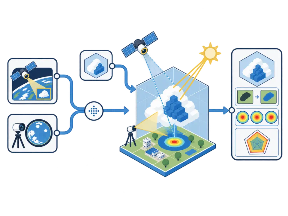
This research explores the complementary strengths of two cloud-observation sources. Satellite data provide broad spatial coverage, while ground-based cameras capture rapid local changes. Aligning both viewpoints makes it possible to estimate cloud position and motion, then assess their effects on surface irradiance.
Tools & Technologies

Skills Applied

Our Approach

4 Project Steps

  1. Step 1 of 4

    Data Integration

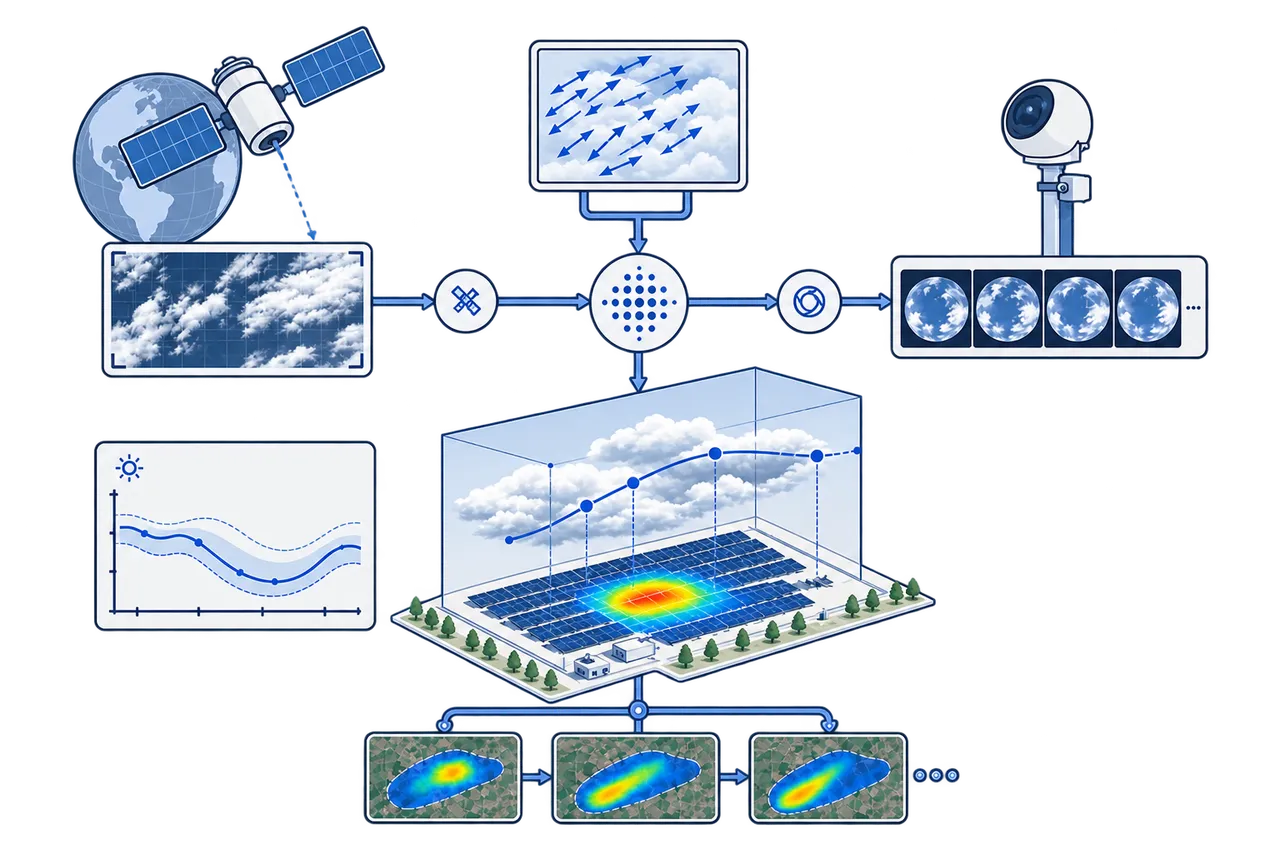
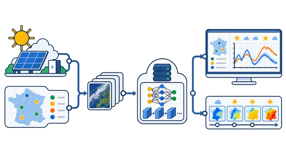
    Satellite-derived data, including HelioClim, describe cloud cover every 15 minutes. Hemispheric sky cameras capture local cloud motion every minute. Both time series are synchronized and aligned within a shared 3D coordinate system.

  2. Step 2 of 4

    3D Cloud Localization and Shadow Mapping

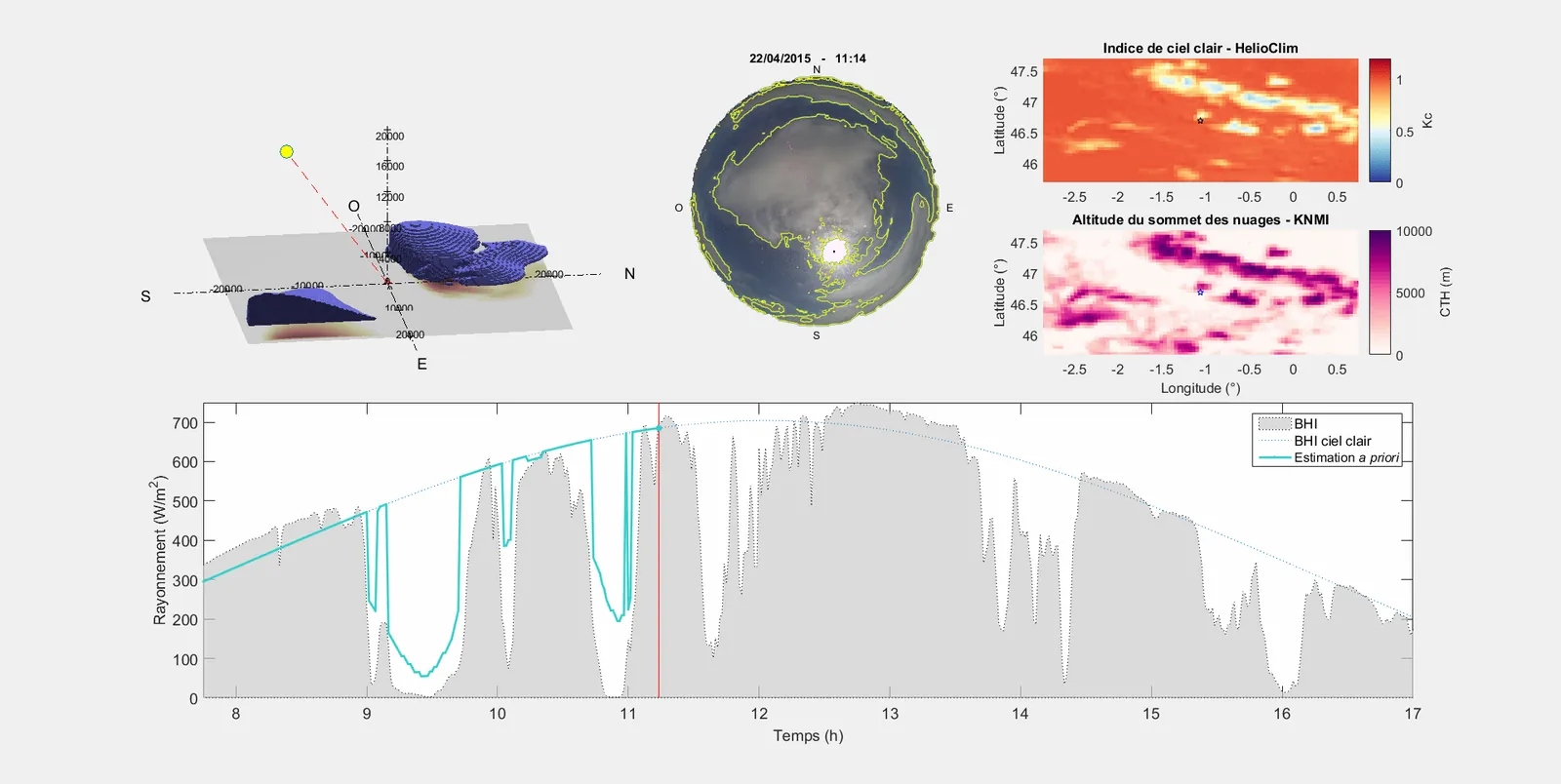
    Clouds observed from the ground and from space are projected into the same 3D volume. Combining both viewpoints provides estimates of cloud position and height, which are then used to calculate shadow paths and surface irradiance.

    Skills Applied

    Tools & Technologies

  3. Step 3 of 4

    Forecasting Process

    Cloud motion vectors are calculated from successive images and extrapolated to forecast cloud displacement and irradiance variations over the next 10 to 15 minutes. The objective is to anticipate rapid changes in photovoltaic production caused by moving clouds.

    Tools & Technologies

  4. Step 4 of 4

    Results

    Within the experimental framework, combining both data sources improves cloud localization and the representation of cloud motion compared with using either source alone. This provides a more precise basis for very-short-term solar forecasting.

    Skills Applied

Regional Solar Power Forecasting with Deep Learning
R&DEDF · Paris

Regional Solar Power Forecasting with Deep Learning

Spatiotemporal forecasting of regional photovoltaic production from Meteosat image sequences using a ConvLSTM model trained and evaluated against measured production and a persistence baseline.

View Project
3D Cloud Geometry Simulator
PhD Research2017Mines Paris - PSL

3D Cloud Geometry Simulator

Controlled simulator of 3D cloud scenes, generating synthetic satellite and ground-camera views to validate voxel-based reconstruction, cloud localization, and shadow prediction for solar forecasting.

View Project